Mobility
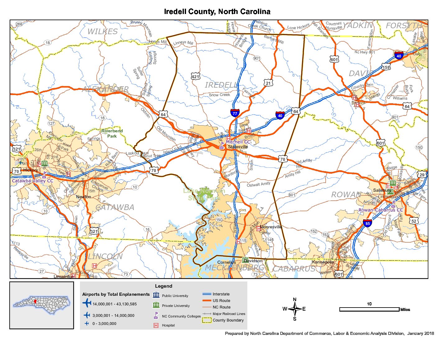
North Carolina’s state-controlled highway mileage makes it the 2nd largest highway system in the country. Iredell County is the center point in the State where Interstates 40 and 77 intersect, earning the county the tageline “Crossroads for the Future”. A $260 Million investment is underway on improvements to the I40/77 interchange and is projected to be complete in 2024. Highway 70, connecting Statesville to Salisbury, is four-lane highway and a major industrial cooridor that provides another route to access Interstate 85.
There are several different organizations that engage in transportation initiatives and policies in Iredell County. Iredell County is a member of the Charlotte Regional Transportation Planning Organization (CRTPO) and recently completed a transportation plan for the County that compliments the transportation plans of the region and local municipalities.
Iredell County Transportation Planning
Statesville Transportation Planning
Mooresville Transportation Planning
Troutman Transportation Planning
The Lake Norman Transportation Commission is the regional group that organizes under the CRTPO and consists of the Towns of Mooresville, Davidson, and Troutman, the City of Statesville and Iredell County. The purpose of the LNTC is to advocate and persuade local, State and Federal officials to give high priority to needed road, interstate and commuter rail improvements which facilitate the quality of life in north Charlotte, Mecklenburg and Iredell Counties, and in the Lake Norman region while providing the vital infrastructure needed for continued economic growth.
Lake Norman Bike Route
North Carolina’s first regional bicycle plan has been endorsed by the four counties surrounding the Lake (Catawba, Iredell, Lincoln, and Mecklenburg) and the nearby municipalities. It was adopted in 2010 by the LNRPO, Unifour RPO, and the Mecklenburg–Union MPO. In years to come, the LNBR will take shape as a continuous, multi-jurisdictional bicycle route that will encircle Lake Norman, segment-by-segment. It will connect prominent destinations, neighborhoods, and various local bicycle facilities within the surrounding area; providing a safer, useful, and attractive transportation and recreation resource for a wide range of bicyclists. For more information, and downloadable verisons of the plan, visit here.


